
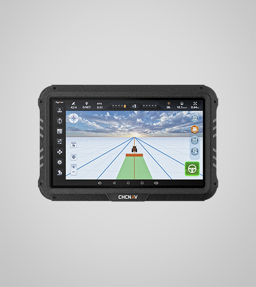
To stay ahead of the curve in a market where geographic accuracy is key to success, mapping technology companies need to be constantly inventing new products and services. By combining this philosophy with state-of-the-art technologies like the tractor autosteer kit, we have been able to reimagine precision agriculture at CHCNAV Agriculture. One such system that follows this principle and provides modern farms with unparalleled accuracy, connectivity, and adaptability is the CHCNAV NX510 SE Integrated Automated Steering System. Using our flagship product as an example of greatness, we delve into the tactics that drive geospatial leaders forward below.
Precision at Scale – The Backbone of Geospatial Innovation
For geospatial and mapping technology companies, precision is non-negotiable. The NX510 SE’s tractor autosteer kit delivers 2.5cm accuracy even at speeds up to 30 km/h, a benchmark that transforms field operations. By integrating GNSS (Global Navigation Satellite System) and INS (Inertial Navigation System) technology, the system compensates for terrain variations, ensuring consistent performance on slopes, in dusty conditions, or during high-speed tasks like tilling or harvesting.
This level of precision is critical for geospatial firms aiming to scale. Whether mapping thousands of acres or optimizing crop inputs, the NX510 SE reduces overlap, minimizes waste, and maximizes yield potential. For CHCNAV Agriculture, this isn’t just about hardware—it’s about empowering farmers to turn geospatial data into profitable, sustainable outcomes.
Seamless Connectivity – Integrating Data Ecosystems
Modern geospatial solutions thrive on connectivity. The NX510 SE’s tractor autosteer kit supports wireless (Wi-Fi, Bluetooth) and cellular (4G LTE) communication, alongside a 410-470 MHz modem and CAN/RS232 ports for hardware integration. This multi-layered connectivity ensures real-time data exchange between tractors, drones, cloud platforms, and farm management software.
For geospatial companies, this interoperability is a game-changer. By syncing the tractor autosteer kit with third-party tools, CHCNAV Agriculture enables farmers to streamline workflows—from soil sampling to variable-rate application. This holistic approach eliminates data silos, accelerates decision-making, and unlocks the full value of geospatial investments.
Adaptability – Designing for Diverse Environments
Geospatial technology must perform flawlessly across industries and terrains. The NX510 SE’s tractor autosteer kit rises to this challenge with its rugged design and universal compatibility. Whether mounted on compact tractors for vineyards or heavy-duty machinery for broadacre farming, the system adapts seamlessly, maintaining accuracy in diverse conditions.
For geospatial firms, this adaptability is key to capturing global markets. By offering solutions that work equally well in subtropical rice paddies and arid wheat fields, CHCNAV Agriculture demonstrates how versatility drives adoption. The tractor autosteer kit isn’t a one-size-fits-all product—it’s a flexible foundation for precision agriculture, wherever it’s needed.
Conclusion
As geospatial and mapping technology companies navigate a rapidly changing landscape, strategies like precision at scale, seamless connectivity, and adaptability will define success. The CHCNAV NX510 SE Integrated Automated Steering System embodies these principles, offering farmers a tractor autosteer kit that transforms data into action. By prioritizing innovation without compromise, CHCNAV Agriculture isn’t just keeping pace with the industry—we’re reshaping it.
Join us in pioneering the future of geospatial technology. Whether you’re a seasoned professional or a new entrant, the NX510 SE proves that with the right tractor autosteer kit, the possibilities are limitless.
